Senses: Sound
Soundscapes and noise pollution
What the sea can hear
Between 2018 and 2022, NOAA and the US Navy moored about thirty hydrophones, underwater microphones, in eight national marine sanctuaries. They stretch from the coral atolls of Papahānaumokuākea, a thousand kilometres north-west of Honolulu, to the reefs of the Florida Keys and the fishing grounds of Stellwagen Bank off Boston. The project, SanctSound, recorded around the clock. It logged every ship, whale and fish chorus it could find in the recordings and published all of it.
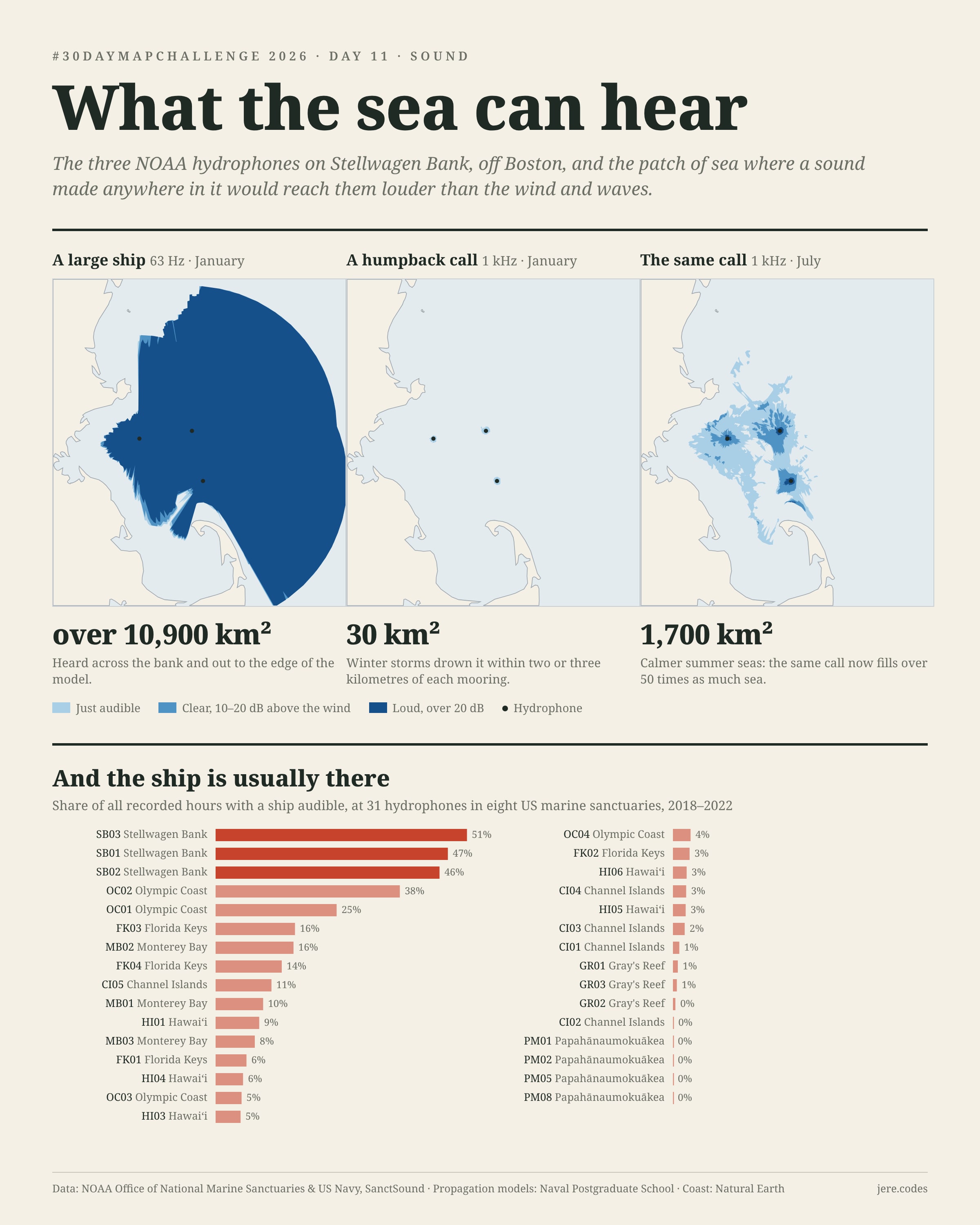
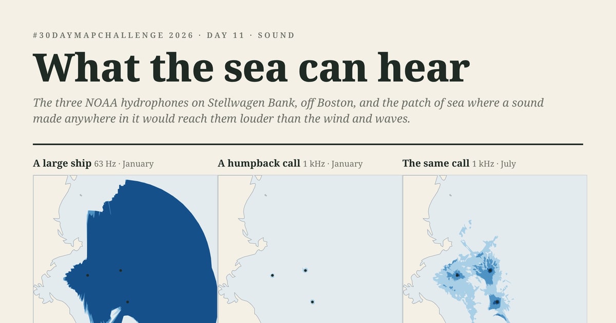
A hydrophone doesn't hear a point. It hears a patch of ocean, and the size of that patch depends on the sound: how low it is, how loud, how deep in the water it starts. It also depends on the season, because wind sets the background noise and the water's temperature layers bend sound up or down. The Navy's propagation model worked that patch out for every hydrophone. This map draws it for three sounds: the 20 Hz pulse of a fin whale, the 63 Hz hum of a large ship and a 1 kHz humpback call. Then it asks how often the loudest of the three is actually there.
Loading the hydrophones…
A ship fills the map, a humpback barely leaves the mooring
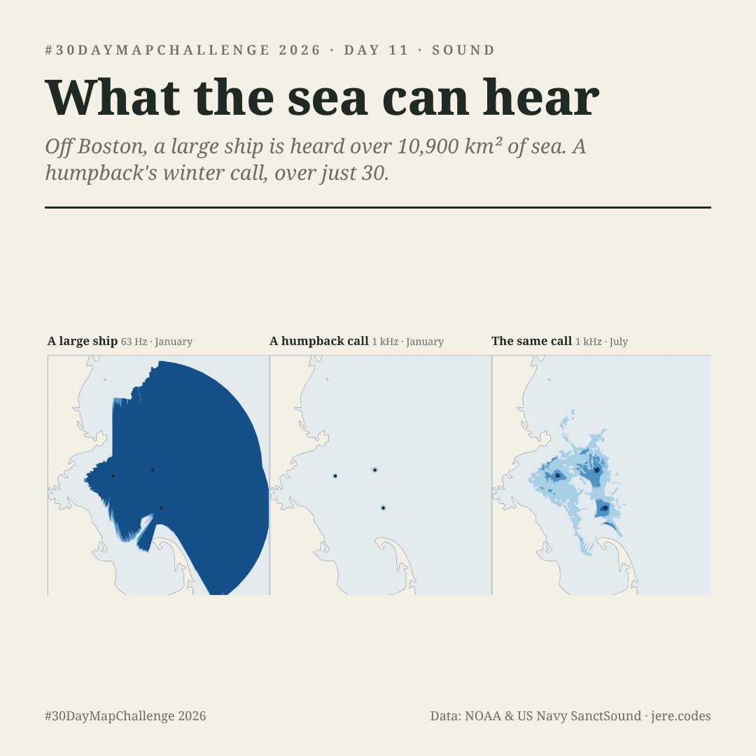
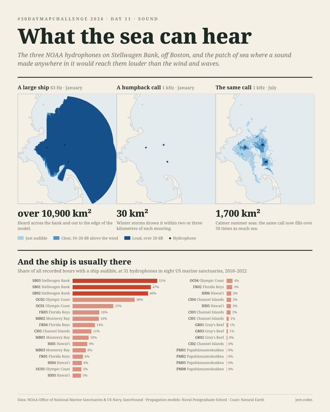
Low sounds travel. A large ship's propeller and engines put out a hum around 63 Hz at about 192 decibels. At a typical hydrophone that hum stays louder than the wind and waves over about 4,800 km² of sea, and at most sites it is still audible where the model stops, 50 to 70 km out. A fin whale's 20 Hz pulse carries almost as far. A humpback call at 1 kHz is quieter and higher, and the sea soaks it up quickly. It fades into the background within a few kilometres, over a typical 22 km². At the same hydrophone, in the same month, the ship is heard over about 180 times more sea.
The shapes are not circles. Islands cast acoustic shadows: CI01, moored off the north shore of Santa Rosa Island, hears the Santa Barbara Channel and almost nothing behind the island. Sound runs a long way down deep channels and dies in shallow, sandy water, which is why the shallow reef at Gray's Reef (GR02, 17 m down) hears a ship over only about 500 km². The deepest hydrophone, a kilometre down off Papahānaumokuākea (PM08), hears the furthest of all.
Summer opens up the sea
Switch the month and the low sounds barely move, but the humpback call does. At Stellwagen Bank it is heard over about 12 km² in January and over 900 km² in July. Two things change between the seasons. Winter storms raise the background: the model's wind noise at 1 kHz there is 7 dB quieter in July, so a call stays above it for longer. And warm summer surface water changes how sound bends on its way through the water. Humpbacks feed on Stellwagen in summer, so the calmer season is also the one when their calls reach furthest.
How often the ship is actually there
A big listening area only matters if something is making noise in it. SanctSound's analysts marked every passage of a ship they could hear in the recordings. Stellwagen Bank, crossed by the shipping lanes into Boston, hears a ship in about half of all hours, around fifteen passages a day. The Olympic Coast, at the mouth of the Strait of Juan de Fuca, is next. On both, the traffic barely stops at night. In the Northwestern Hawaiian Islands, four hydrophones logged three ship passages in 1,369 days. Everywhere else the ships keep office hours: quiet at night and busiest between nine and eleven in the morning, as fishing, dive and tour boats go out.
Method
- Listening areas come from SanctSound's propagation models, run by the Naval Postgraduate School with the Navy Standard Parabolic Equation model. Sound is traced along 360 bearings from each hydrophone, through monthly sound-speed profiles, the seabed and the bathymetry, out to a fixed radius (usually about 70 km).
- A place counts as in earshot when the modelled received level is above the wind-driven background noise for that month (a signal-to-noise ratio above 0 dB). The bands on the map are 0–10, 10–20 and over 20 dB. Other ships and animals are not part of the background, so this is the best case, a calm sea with nothing else going on.
- The three sources are SanctSound's own: 63 Hz at 192 dB re 1 µPa at 1 m, 20 m deep (their large commercial vessel); 1 kHz at 165 dB, 1 m deep (their humpback call); and 20 Hz at 189 dB, 15 m deep, the frequency and level of a fin whale's pulse.
- Areas are summed over the model's polar grid. Where sound still reaches the hydrophone at the model's edge, the true area is larger, and the charts show that with an open dot. The map outlines are simplified to about 300 m.
- Ship time is the total length of all detected ship passages divided by the length of each deployment, summed over every deployment at the site. Hours of the day are local solar time from the hydrophone's longitude.
- Recordings are SanctSound's published clips, cut to 20 seconds and levelled. Very low calls (blue and fin whales) use the team's sped-up versions so you can hear them.
Sources
- NOAA Office of National Marine Sanctuaries and US Navy, SanctSound Raw Passive Acoustic Data (2020). Recordings and clips
- T. Margolina, Naval Postgraduate School, Sound Propagation Models, SanctSound Data Products. Listening areas
- SanctSound data products: ship detections and sound clips (NOAA NCEI, Google Cloud public dataset)
- SanctSound: "How far can we listen?". The vessel and humpback sources
- M. D. Collins, "A split-step Padé solution for the parabolic equation method", JASA 93 (1993)
- Basemap: OpenFreeMap, © OpenMapTiles, data © OpenStreetMap contributors
Share it
Three sizes, ready to post. Tap one to open it, or download it.
The second of five Senses maps this month, after Day 5, Sight. Recordings from the sanctuaries are on the map above. Pick a hydrophone and listen.
Previous entry: Day 10, How far to the loo?. More maps from the month are in the #30DayMapChallenge 2026 gallery.